Zambia
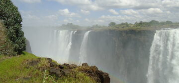
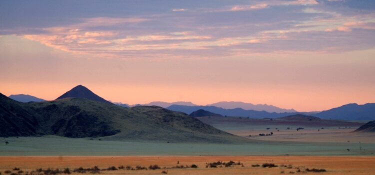
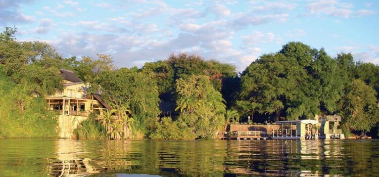
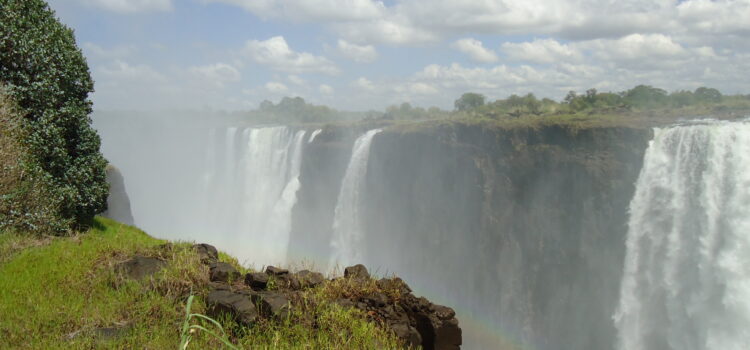
Zambia is a country dominated by wilderness and an amazing sense of space. Lush river valleys and floodplains offer excellent habitat for a huge range of wildlife species, as do the dense woodlands that cover much of the country. It is also one of the home of the mighty Victoria Falls which stretches across both Zambia and Zimbabwe.
General Information
Still relatively unexplored by most visitors to Africa, Zambia conjures images of a bygone era, with vast areas of pristine wilderness still to be fully discovered. The roads are generally unsuitable for self-driving and distances between the highlights are huge. The infrastructure is improving but the best way to visit Zambia is still to take an organised safari with an experienced tour operator.
Geography – Environment
Zambia is dominated by its namesake, the Zambezi River which rises in the northwest and forms the country’s southern boundary. Zambia is landlocked and bordered by Zaire in the north and northwest, Tanzania in the northeast, Malawi in the east, Moçambique in the southeast, Zimbabwe in the south, Botswana and Namibia in the southwest and Angola in the west! With an area of 750,000 square kilometres, Zambia is based around a central plateau with a height of 1060 to 1363m above sea level. The landscape is mostly flat with isolated mountain ridges and outcrops containing the country’s mineral wealth.
The level of the land falls moving southwards from the Zaire border to the Zambezi, and the central plateau is broken by the huge valleys of the Zambezi and its main tributaries; the Kafue and Luangwa being the largest.
The three natural lakes of Zambia (Bangweulu, Mweru & the southern end of Tanganyika) all originate from headwaters in Zaire. The northern section of Lake Kariba also lies in Zambia; Kariba is the largest man-made lake in the world at 5000 square km.
History, Culture and Politics
Zambia lies on the Central African Plateau and at the southern end of the Great Rift Valley. A number of early Stone Age sites have been uncovered throughout the country; the main sites are located at Kalambo Falls in the north and Victoria Falls in the south. Evidence of the use of fire up to 60,000 years ago has been found at Kalambo Falls. By the late Stone Age, around 15,000 years ago, people were using cave shelters and creating rock paintings of which unfortunately only a few have survived due to Zambia’s humid climate. These early people were probably of San descent, as in other areas of Southern Africa.
Between 300BC & AD400, Bantu speaking tribes moved south and dominated the area that is now Zambia. They brought with them domestic animals, pottery and tool making skills, and began to concentrate on agriculture and a more settled way of life. With the discovery of copper around AD350, mining began and currency and jewellery was made. Trade with Swahili tribes began around AD1500 – 1800 and at this time many of the tribes in the Zambian area were organised into chieftaincies or monarchies. The Chewa tribe was dominant in the east, the Lozi in the west and the Bemba & Lunda in the north. By the 18th century, trade links were strong from the Atlantic coast to the eastern shores of the African continent. Copper, ivory, rhino horn, and slaves were the main trade commodities.
Influences from Europe began to filter into the area from the time of the Portuguese landings, around 1515. The people of this area would also experience the influence of the Dutch and British colonisation of the Cape from 1652 onwards. Portuguese explorer, Vasco da Gama, landed on Mozambique Island in 1497, and by 1515 Portugal had established colonies at Mozambique and on the western coast of Africa at present day Angola. In the 1790’s, the Portuguese began to travel into Zambia from Angola.
The actions of Shaka Zulu and his nation around 1818 forced many tribes to move north to avoid repression and violence. A Sotho clan, the Kololo, was one of the first to escape, along with two other groups of Ngoni people. They crossed the Zambezi in 1835 and moved north as far as the southern end of Lake Tanganyika. In 1865 they established themselves permanently in Zambia’s eastern province. At this time, present day Zambia was not a country as such, but was occupied by a number of varied and distinct kingdoms, for instance the Bemba, Lunda, Kololo and Chewa.
David Livingstone had visited the Kololo in 1851 during his travels north and had been appalled by the extent of the slave trade. In conjunction with the Kololo, Livingstone had plans to establish a system of ‘fair trade’ promoting ivory and cotton among other goods. Before extensive trade could begin, an export route had to be found that would enable the goods to be transported in bulk to the coast. Livingstone first trekked from Barotseland (the home of the Kololo) to the Angolan port of Luanda, this journey proved to be a failure with the terrain being completely unsuitable for transportation.
Livingstone next tried the Zambezi River which he believed would be the perfect route. During his journey towards the coast, he ‘discovered’ the magnificent Victoria Falls and returned to England with tales of wonder. Unfortunately, Livingstone had failed to travel the full length of the Zambezi, and subsequent plans to use the river as a trade route into the interior were abandoned when the Cahora Bassa gorge in Mozambique was discovered to be un-navigable.
Following Livingstone’s death in 1873, many missionaries were sent to Zambia from Scotland, France and other countries. Zambia became better known to the outside world and by the end of the 19th century; the British South Africa Company (BSAC) had taken over Zambia as part of Cecil Rhodes’ plan to control Africa from the Cape to Cairo. Suddenly, the country of Zambia was arbitrarily marked out and the separate kingdoms that had existed prior to colonial takeover were thrown into single governance. In 1911, the area was named Northern Rhodesia, Southern Rhodesia being present day Zimbabwe. The capital was the town of Livingstone, located next to the Victoria Falls. The capital was moved to Lusaka in 1935.
Treaties of submission were obtained from the kings and chiefs of the countries tribes, often by fraud and deceit. However, official slavery was abolished. A hut tax was imposed on local people, to raise funds for work on the Cape to Cairo railway and to pay for the administration of the country. A rebellion followed with many villages being destroyed and inhabitants being taken into forced labour in the South African or Southern Rhodesian mines. Vast tracts of land were given to white settlers and around 20,000 Zambians also found themselves forcibly recruited as porters for British troops fighting WWI in East Africa.
In 1923 the British Colonial Office took Zambia over as a protectorate and promised to run the country with African interests as a paramount concern. The reign was very paternalistic and although things were a little better, Zambians were still subject to pass laws and limited land ownership. The copper mines which had been worked on a very small scale basis hundreds of years ago were re-discovered in the 1920’s and the ‘copperbelt’ as it was known became one of the world’s most concentrated mining areas. Many Zambians migrated to the area for work and this was a catalyst in breaking down traditional tribalism with everyone living and working together.
The mines were initially run exclusively under white management, but a series of strikes against taxes and poor pay led to black Zambians eventually being included in management in the 1950’s. At the end of the 1940’s, the Northern Rhodesia African Nationalist Congress was formed out of various welfare associations which had been initiated by Missionary school graduates who had been taught something of politics. The Congress leader was Harry Nkumbula.
Things were to become economically worse for Zambia with the formation of a federation including Nyasaland (Malawi), Southern and Northern Rhodesian in 1953. Northern Rhodesia became the financial supporter of a failing Southern Rhodesian economy and millions of dollars were siphoned off to the South.
The fully fledged fight for independence began in the mid 1950’s when Nkumbula’s Congress split and the Zambian African National Congress was formed, followed by the United National Independence Party in 1958 with Kenneth Kaunda as it’s leader. Intense rivalry between the two parties resulted. In 1963 the colonial federation was dissolved and Zambia’s first elections were held in 1964 with UNIP winning and Kaunda becoming the first president.
Today Zambia’s population is made up of around 70 different tribes, numbering approximately 18 million people. No single traditional culture is dominant and the Zambian people regard themselves as a united nation with little tribal animosity. Most of the population live in urban areas, unusual for a developing country, and the growth rate is a high 2.9%. Unemployment in the cities is huge with many people taking part in informal employment such as street markets. Primary education and health care are free and 95% of the population attend the first stages of school. However, the dropout rate is high and health care is still inadequate to cope with demand.
Health & Malaria
Most of Zambia is a malaria area and recommended prophylaxis should be taken. The low lying river valleys are where malaria is most virulent and extra care should be taken in these areas. Your doctor can advise you on the best type for the area of travel and your personal requirements. However, taking prophylaxis will not guarantee that you will not contract malaria! The best way to avoid malaria is to avoid being bitten by the mosquitoes that carry the parasite. Only the females of one species of mosquito (Anopheles) carry the tiny parasite, and the greatest incidence of malaria is in areas of high population where there are many people for the mosquito to bite and pass the parasite between.
Mosquitoes usually bite between sunset and sunrise, so make sure that you are covered up during this time! Wear loose fitting, long sleeved shirts and trousers, use a good insect repellent and sleep underneath a mosquito net or in a tent/ room sealed with netting. If you do develop flu-like symptoms, or feel at all unwell, during your holiday or after your return home, you must make sure that your doctor knows that you have recently travelled in a malaria area. Malaria is not a serious problem provided people take adequate precautions and seek advice and treatment immediately if they feel unwell.
Zambia’s major private hospitals are of a fair standard; however, serious medical cases will be evacuated by air to South Africa where further facilities are available. You must make sure that comprehensive travel insurance is taken out before you travel, this insurance should cover any medical expenses, air evacuation and repatriation if necessary. It must also cover delay, curtailment, or cancellation of your holiday or any associated flights.
Water
The water is safe to drink in Zambia’s towns, when visiting the remote areas purification tablets should be used, or bottled mineral water bought en-route. Plenty of water must be drunk to prevent dehydration. We recommend 2-3 litres minimum, excluding beverages such as tea, coffee, juice and alcohol. Dehydration is responsible for many emergency evacuations and can cause very serious problems, it is totally avoidable, so don’t let this spoil your holiday!
Climate
- Rainy season: December to April. Rainfall does not usually occur every day, and generally takes place in the afternoon with mornings being fairly clear.
- Summer: September to April with a high of 35° C and a low of 18° C.
- Winter: May to August with a high of 27° C and a low of 10° C.
The best time to visit Zambia is in the winter months of May to August, and many safari operators do not run trips into the National Parks during the rainy season due to the condition of the roads and the intensity of the heat in lowland areas.
Photography
Bring plenty of memory cards and a spare camera battery as these items may not be available in some of the more remote areas of Zambia. A good zoom lens (minimum 200 mm) is essential for wildlife photography.
Clothing
Neutral, muted colours such as khaki, dark green or beige ensure as little disturbance to wildlife as possible whilst on game drives or walks. White or bright colours are not advised and army camouflage uniforms or army hats are not recommended.
Recommended Packing
Neutral coloured casual clothing (shorts/shirts) for everyday wear, stout shoes (with soles thick enough to protect against thorns and for walking), light waterproof jacket for summer, warm jumper/ fleece for winter, warm long trousers for winter, two sets of good casual clothes for evening dining where appropriate, towel, broad brimmed hat, sunglasses, sunscreen, camera, plenty of memory cards & spare battery, binoculars, reliable torch, sleeping bag if camping. It is also worth noting that if you are travelling by light aircraft or as part of a guided safari, you should carry no more than 10-15kg of luggage in a soft bag for ease of packing.
Currency
Zambia’s currency is the Zambian Kwacha which is divided into 100 ngwee, although these coins are very rarely used due to devaluation. US$ can be exchanged throughout the country, as can Euro and pounds sterling although US$ generally receives a better rate. Most accommodation establishments accept credit cards, mainly Visa or Mastercard, although this should be checked before arrival. Fuel cannot be purchased with credit cards, and in the more remote areas most places only accept cash.
Visa Requirements
Visitors from the Commonwealth and some other European countries can obtain tourist visas for up to 3 months at the border. The cost depends on your nationality. Please contact us for details regarding your personal visa requirements. From 1st October 2022 visitors to Zambia carrying passports from the UK, the USA, Canada, Norway, Australia and the European Union no longer need to purchase a tourist visa.
